Google made people’s lives easier through technology and innovation in the modern era. Everyone uses Google Maps to reach out to the destination place, not only Google helps to cover the distance also saves traveling time and finds the shortest and fastest route to your point. In the new update, Google started showing out live traffic updates on the map in different color lines like Green, Red, yellow on highways and on normal service roads, so that you can see live traffic conditions on your route that road is clear or is there any heavy traffic condition.
Here we will know what are the different color line means and what color represent the traffic.
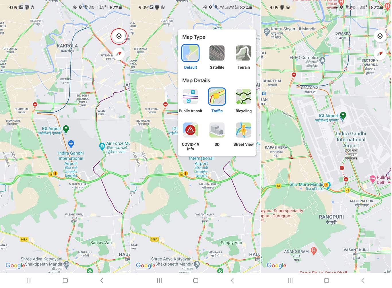
- Green lines on the Google map in traffic view indicate that the path is clear for more than 50 miles and you can move 80 km per hour or more.
- Red lines on the map indicate that highway traffic is moving at less than 25 miles with a speed of 40 km per hour and could indicate an accident or congestion on that route.
- Yellow lines on the map indicate that traffic moves faster, from 25 to 50 miles with a speed of 40.2 to 80.46 km per hour.
- If you see grey lines on the map, that indicates that there’s no traffic information available at the time.
- The Red-black line on the map indicates extremely slow or stopped traffic.
How to Check the Traffic Around you on Google Maps Application
- Step 1) Open Google Maps application in mobile.
- Step 2) Now Click on the Map switching icon and select as traffic map.
- Step 3) When you will switch the map, it will show lines on highways and service roads in different colors.
Leave a Reply